Wyoming Mesonet
Water Resources Data System and State Climate Office
SEO WACNet, UW USACE UMRB, USDA-ARS, BLM
The Wyoming Mesonet
The Wyoming Mesonet is an ever-expanding network of high-quality weather stations around the state. Maintenance and installation of stations is performed by cooperating agencies while data are collected, stored, and delivered by the Wyoming State Climate Office and Water Resources Data System. Cooperators include the State Engineer's Office, University of Wyoming/Army Corps of Engineers, the Bureau of Land Management, USDA Agricultural Research Service, and the University of Wyoming College of Agriculture and Natural Resources.
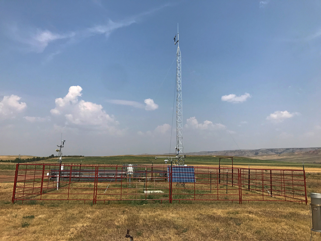
Station 7 Miles ESE of Sheridan
Currently 30 stations are deployed in 15 of Wyoming's 23 counties.
UMRB Soil Moisture and Snow Monitoring Network
Aladdin 5SW
Alva 12NNW
Arvada 15NE
Banner 7N
Biddle 18SE
Bill 8NE
Boysen Reservoir
Buffalo 8S
Buffalo Bill Reservoir
Carlile 2S
Clearmont 15ESE
Colony 8NW
Cowley
Devils Tower 16WNW
Diversion Dam
Edgerton 18E
Four Corners 11NW
Hulett 6NW
Kaycee 23NNE
Kaycee 9SE
Lance Creek 4ENE
Linch 24NNE
Linch
Midwest 12WSW
Newcastle 13SSW
Osage 2ENE
Osage 31SW
Powell
Recluse 13NNE
Rozet
Saddlestring 24E
Sheridan
Upton 10S
Worland 3E
Wright 9S
Wyarno 6E
SEO Wyoming Agricultural Climate Network (WACNet)
Baggs 2E
Big Piney 11W
Boulder 2SE
Burlington 2NE
Daniel 10NW
Daniel 8S
Devils Gate
Douglas 4NW
Elk Mountain 6S
Encampment 5NE
Farson 5S
Granger 6NW
LaBarge 2S
Lingle 2W
Lonetree
Lyman 1SW
Pavillion 2N
USDA-ARS Rangeland Resources Research
Cheyenne
Thunderbasin Grasslands
UW College of Ag and Natural Resources
Bureau of Land Management
Creston
Tablerock
Wamsutter 2NW