Water Resources Data System & State Climate Office
Water Resources Data System & State Climate Office
Water Resources Data System & State Climate Office


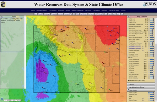
The Water Resources Data System at the University of Wyoming, in conjunction with the Wyoming Water Development Commission, is pleased to announce the launch of The Wyoming Water and Climate Explorer. This online web-mapping tool explores and delivers climate, weather, snowpack, streamflow, and State water development information. See also GIS Standards.
Enter the Water and Climate Explorer
The Explorer allows users to visualize different water and climate data resources in specific geographic regions, and then retrieve information related to that area. For example, if a water user is interested in applying for funding for a water development project from the Wyoming Water Development Commission, they can zoom-in to their of interests, click on the map and find out what reports, studies, or construction projects have been done in the vicinity. They can also find information related to area water rates, well depths and yields, stream gages, and where the nearest National Weather Stations are located to get information about the regions precipitation.
The goal of this mapping portal is to allow Wyoming's water users and managers to find as much information they can, in one spot, on one of our state's most precious resources.