Water Resources Data System & State Climate Office
Water Resources Data System & State Climate Office
Water Resources Data System & State Climate Office
WRDS/SCO may be working remotely so there could be a slight delay returning phone calls. Please email wrds@uwyo.edu if you are in need of information and we will respond as soon as possible
GIS and Map Products
GIS Standards
Water Development Commission's GIS webpage. Provides templates & technical memos for WWDC projects
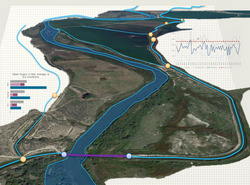
Water & Climate Explorer
Users can view water & climate resources in specific geographic regions & retrieve data from that area
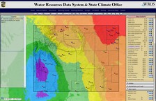
Map-based retrieval of NWS and CoCoRaHS climate data
Precipitation and temperature data from stations throughout Wyoming
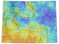
PRISM Climate Maps
Map server allowing retrieval of monthly & annual data for temperature and freeze/frost information
Contact us for more Info
Contact WRDS for additional GIS data related to Water Development Commission Products