Supercell over Laramie
WRDS/SCO may be working remotely so there could be a slight delay returning phone calls. Please email wrds@uwyo.edu if you are in need of information and we will respond as soon as possible

Wyoming Conditions Maps
as of Tue, 23 Apr 2024.
Other Data Products


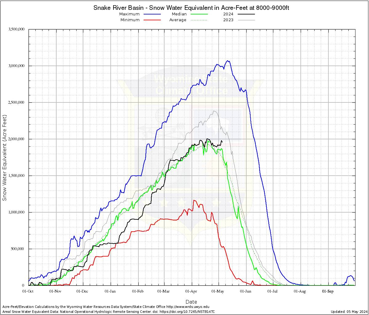
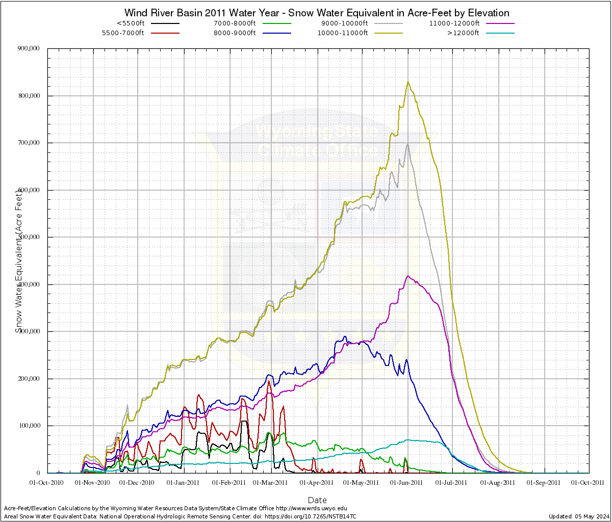
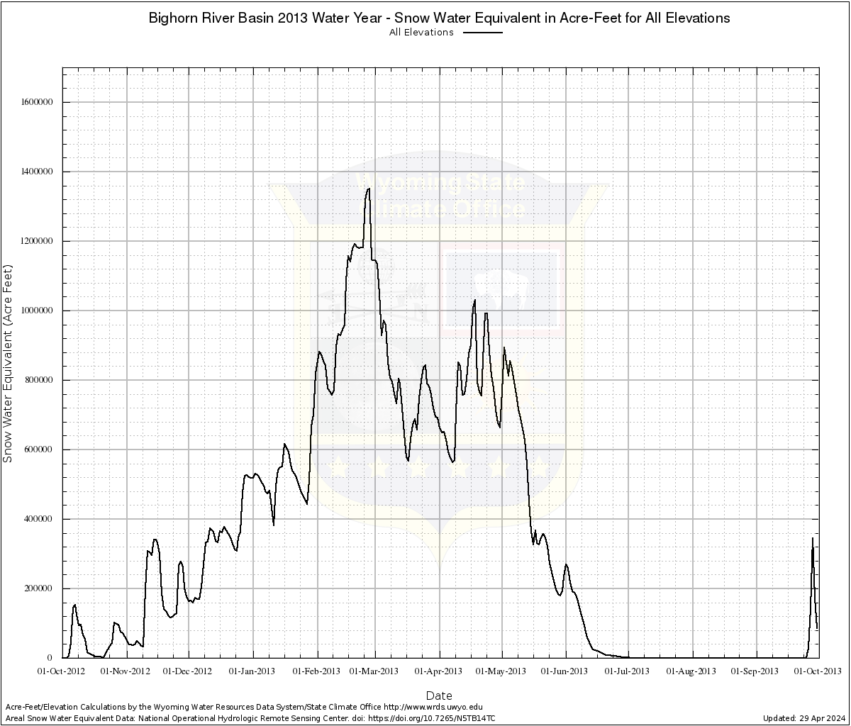
Data on these pages show the estimated total snow water equivalent in each basin by year (Water Year 2004 to Current [2023]) as well as by elevation. These values do not represent the actual amount of water that will end up in streams since content will be lost to sublimation, evaporation, and infiltration but are modelled currently-on-the-ground values. Data are presented in a variety of views:

Maximum, minimum, median, and average volume for each elevation with the current water year's progress.
Bear
Belle Fourche
Bighorn
Cheyenne
Great Divide
Laramie
Little Missouri
Little Snake
Lower Green
Lower North Platte
Madison-Gallatin
Niobrara
Powder
Shoshone
Snake
South Platte
Sweetwater
Tongue
Upper Green
Upper North Platte
Wind
Yellowstone

Snow water equivalent total at each elevation by year (Water Year 2004 thru present)
Bear
Belle Fourche
Bighorn
Cheyenne
Great Divide
Laramie
Little Missouri
Little Snake
Lower Green
Lower North Platte
Madison-Gallatin
Niobrara
Powder
Shoshone
Snake
South Platte
Sweetwater
Tongue
Upper Green
Upper North Platte
Wind
Yellowstone

Snow water equivalent total for all elevation by year (Water Year 2004 thru present)
Bear
Belle Fourche
Bighorn
Cheyenne
Great Divide
Laramie
Little Missouri
Little Snake
Lower Green
Lower North Platte
Madison-Gallatin
Niobrara
Powder
Shoshone
Snake
South Platte
Sweetwater
Tongue
Upper Green
Upper North Platte
Wind
Yellowstone