Water Resources Data System & State Climate Office
Water Resources Data System & State Climate Office
Water Resources Data System & State Climate Office


The Climate of Wyoming
TOPOGRAPHIC FEATURES
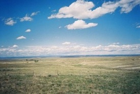
Wyoming's outstanding features are its majestic mountains and high plains. Its mean elevation is about 6,700 feet above sea level and even when the mountains are excluded, the average elevation over the southern part of the State is well over 6,000 feet, while much of the northern portion is some 2,500 feet lower. The lowest point, 3,125 feet, is near the northeast corner where the Belle Fourche River crosses the State line into South Dakota. The highest point is Gannett Peak at 13,785 feet, which is part of the Wind River Range in the west-central portion. Since the mountain ranges lie in a general north-south direction, they are perpendicular to the prevailing westerlies, therefore, the mountain ranges provide effective barriers which force the air currents moving in from the Pacific Ocean to rise and drop much of their moisture along the western slopes. The State is considered semiarid east of the mountains. There are several mountain ranges, but the mountains themselves cover less area than the high plains. The topography and variations in elevation make it difficult to divide the State into homogeneous, climatological areas.
The Continental Divide splits the State from near the northwest corner to the center of the southern border. This leaves most of the drainage areas to the east. The run-off drains into three great river systems: the Columbia, the Colorado, and the Missouri. The Snake with its tributaries in the northwest flows into the Columbia; the Green River drains most of the Southwest portion and joins the Colorado: the Yellowstone, Wind River, Big Horn, Tongue, and Powder drainage areas cover most of the north portion and flow northward into the Missouri; the Belle Fourche, Cheyenne, and Niobrara covering the east-central portion, flow eastward: while the Platte drains the southeast and flows eastward into Nebraska. There is a relatively small area along the southwest border that is drained by the Bear which flows into the Great Salt Lake. In the south-central portion west of Rawlins, there is an area called the Great Divide Basin. Part of this area is often referred to as the Red Desert. There is no drainage from this Basin and precipitation, which averages only 7 to 10 inches annually, follows creekbeds to ponds or small lakes where it either evaporates or percolates into the ground.
TEMPERATURE
Because of its elevation, Wyoming has a relatively cool climate. Above the 6,000 feet level the temperature rarely exceeds 100° F. The warmest parts of the State are the lower portions of portions of the Big Horn Basin, the lower elevations of the central and northeast portions, and along the east border. The highest recorded temperature was 114° F on July 12, 1900, at Basin in the Big Horn Basin. The average maximum temperature at Basin in July is 92° F. For most of the State, mean maximum temperatures in July range between 85 and 95° F. With increasing elevation, average values drop rapidly. A few places in the mountains at about the 9,000 foot level have average maximums in July close to 70° F. Summer nights are almost invariably cool, even though daytime readings may be quite high at times. For most places away from the mountains, the mean minimum temperature in July ranges from 50 to 60 ° F. Of course, the mountains and high valleys are much cooler with average lows in the middle of the summer in the 30s and 40s with occasional drops below freezing.
In the wintertime it is characteristic to have rapid and frequent changes between mild and cold spells. Usually there are less than 10 cold waves during a winter, and frequently less than half that number for most of the State. The majority of cold waves move southward on the east side of the Divide. Sometimes only the northeast part of the State is affected by the cold air as it slides eastward over the plains. Many of the cold waves are not accompanied by enough snow to cause severe conditions. In January, the coldest month generally, man minimum temperatures range mostly from 5 to 10° F. In the western valleys mean values go down to about 5° below zero. The record low for the State is -66° F observed February 9, 1933, at Yellowstone Park. During warm spells in the winter, nighttime temperatures frequently remain above freezing. Chinooks, warm downslope winds, are common along the eastern slopes.
Numerous valleys provide ideal pockets for the collection of cold air drainage at night. Protecting mountain ranges prevent the wind from stirring the air, and the colder heavier air settles into the valleys often sending readings well below zero. It is common to have temperatures in the valleys considerably lower than on the nearby mountain side. Big Piney in the Green River Valley is such a location. Mean January temperatures in the Big Horn Basin show the variation between readings in the lower part of the valley and those higher up. At Worland and Basin in the lower portion of the Big Horn Basin, not far from the 4,000 foot level, the mean minimum temperature for January is zero, while Cody, close to 5,000 feet on the west side of the valley has a mean January minimum of 11° F. January, the coldest month, has occasional mild periods when maximum readings will reach the 50s; however, winters are usually long and cold.
GROWING SEASON
Early freezes in the fall and late in the spring are characteristic. This results in long winters and short growing seasons. However, it is a county of rapid changes through the fall, winter, and spring seasons, with frequent variations from cold to mild periods. The average growing season (freeze-free period) for the principal agricultural areas is approximately 125 days. For hardier plants which can stand a temperature of 28° F, or slightly lower, the growing season is the agricultural areas east of the Divide is approximately 145 days. In the mountains and high valleys freezing temperatures may occur any time during the summer. For tender plants there is practically no growing season in such areas as the upper Green River Valley, the Star Valley and Jackson Hole. At Farson near Sandy Creek, a tributary of the Green River, the average is 42 days between the last temperature of 32° F in early summer and the first freeze in late summer. For the places like the Star Valley and Jackson Hole, the growing season is even shorter.
SUNSHINE
For most of the State, sunshine ranges from 60 percent of the possible amount during the winter to about 75 percent during the summer. Mountain areas receive less, and in the wintertime the estimated amount over the northwestern mountains is about 45 percent. In the summertime when sunshine is greatest - not only in time but also intensity - it is characteristic for the mornings to be mostly clear. Cumulus clouds develop nearly every day and frequently blot out the sun for a portion of the afternoons. Because the altitude provides less atmosphere for the sun's rays to penetrate and because of the very small amount of fog, haze, and smoke, the intensity of sunshine in unusually high.
PRECIPITATION
Like other states in the west, precipitation varies a great deal from one location to another. The period of maximum precipitation occurs in the spring and early summer for most of the State. Precipitation is greater over the mountain ranges and usually at the higher elevations, although elevation alone is not the predominant influence. For example, over most of the southwest portion, where the elevation ranges from 6,500 to 8,500 feet, annual precipitation varies from 7 to 10 inches. At lower elevations over the northeast portion and along the eastern border, where elevations are mostly in the range from 4,000 to 5,500 feet, annual averages are from 12 to 16 inches. The relatively dry southwest portion is a high plateau nearly surrounded by mountain ranges.
The Big Horn Basin provides a striking example of the effect of mountain ranges in blocking the flow of moisture laden air from the east as well as from the west. The lower portion of the Basin has an annual precipitation of 5 to 8 inches, and it is the driest part of the State. The station showing the least amount is Seaver at 4,105 feet with an annual mean of about 5.50 inches. In the southern part of the Basin, Worland at 4,061 feet has an annual mean of 7 to 8 inches as compared with Termopolis at 4,313 feet and 11 to 12 inches. There is another good example in the southeastern part of the State where Laramie at 7,236 feet has an annual mean of 10 inches, while 30 miles to the west, Centennial at 8,074 feet receives about 16 inches. Only a few locations receive as much as 40 inches a year, based on gage records.
During the summer, showers are quite frequent but often amount to only a few hundredths of an inch. Occasionally there will be some very heavy rain associated with thunderstorms covering a few square miles. There are usually several local storms each year with from 1 to 2 inches of rain in a 24-hour period. On rare occasions, 24-hour amounts range from 3 to 5 inches. The greatest 24-hour total recorded for any place in Wyoming is 5.50 inches at Dull Center, near Newcastle, on May 31, 1927.
HUMIDITY AND EVAPORATION
The average relative humidity is quite low and provides delightful summer weather. During the warmer part of the summer days, the humidity drops to about 25 to 30 percent, and on a few occasions it will be as low as 5 to 10 percent. Late at night when the temperature is lowest, the humidity will generally rise to 65 or 75 percent. This results in an average diurnal variation of about 40 to 45 percent during the summer, but in the winter the variation is much less. Low relative humidity, high percentage of sunshine, and rather high average winds all contribute to a high rate of evaporation. Because of frequent spells of freezing weather before May 1 and after September 30, it is difficult to obtain consistent records of evaporation for more than the 5-month period from May through September. For this period, the average amount of evaporation is approximately 41 inches, as determined from evaporation pans at a few selected locations. The overall range is from 30 to about 50 inches.
SEVERE STORMS
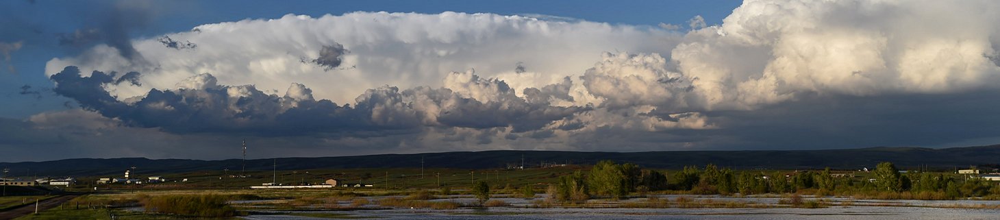
Hailstorms are the most destructive type of local storm for this State, and every year damage to crops and property from hail amount to many thousands of dollars. Occasionally a hailstorm will pass over a city and cause severe damage. Most of the hailstorms pass over the open rangeland and damage is slight, although in small areas of crop producing land, some farmers occasionally lose an entire crop by hail.
Tornadoes occur, but records show they are much less frequent and destructive than those that occur in the Midwest. The relatively small amount of destruction is partly due to the fact that most of Wyoming is open range country and sparsely populated. However, records show that tornadoes which occur here are somewhat smaller and have a shorter duration. Many of them touch the ground for only a few minutes before receding into the clouds. The season extends from April through September. June has the greatest number on the average with May next and most occur in the eastern part of the State.
Wyoming is quite windy, and during the winter there are frequent periods when the wind reaches 30 to 40 miles per hour with gusts to 50 or 60. Prevailing directions in the different localities vary form west-south-west through west to northwest. In many localities winds are so strong and constant from those directions that trees show a definite lean towards the east or southeast.
SNOW AND BLIZZARDS
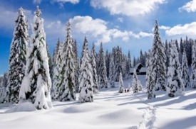
Snow falls frequently from November through May and at lower elevations is light to moderate. About five times a year on the average, stations at the lower elevations will have snowfall exceeding 5 inches. Falls of 10 to 15 inches or more for a single storm occur but are infrequent outside of the mountains. Wind will frequently accompany of follow a snowstorm and pile the snow into drifts several feet deep. The snow sometimes drifts so much that it is difficult to obtain an accurate measurement of snowfall. An unusually heavy snow occurred at Sheridan on the 3rd and 4th of April 1955. During this period the snowfall amounted to 39.0 inches, had a water equivalent of 4.30 inches and blizzard conditions lasted more than 43 hours. High winds and low temperatures with snow cause blizzard or near blizzard conditions. These conditions sometimes last a day or two, but it is uncommon for a severe blizzard to last over three days.
Total annual snowfall varies considerably. At the lower elevations in the east, the range is from 60 to 70 inches. Over the drier southwest portion, amounts vary from 45 to 55 inches. Snow is very light in the Big Horn Basin with annual averages from 15 to 20 inches over the lower portion and 30 to 40 inches on the sides of the Basin where elevations range from 5,000 to 6,000 feet. The mountains receive a great deal more and in the higher ranges annual amounts are well over 200 inches. At Beckler River Ranger Station in the southwest corner of Yellowstone Park, the snowfall averages 262 inches for a 20-year period.
The weather pattern most favorable for precipitation is one with a low-pressure center a little to the south of the State. This will normally provide a condition where relatively cool air at the surface is overrun by warmer moist air. Studies of wind flow patterns indicate that Wyoming is covered most of the time by air from the Pacific. A smaller percentage of time the State is covered by cold air masses that move down from Canada.