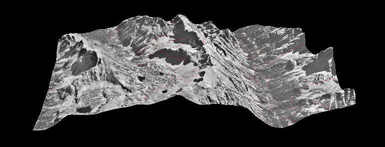
3D Image from the Mount Moran Quadrangle
3D Image from the Mount Moran Quadrangle
The Wyoming Earthquake Program at the Wyoming State Geological Survey is working with the Water Resources Data System to generate 3D images with superimposed landslides for the entire state of Wyoming. To date, over 200 images have been created in Teton County.
The images allow the user to "fly" through the landscape. It is necessary for the user to download viewing software, such as Cortona, in order to view these images. A link to Cortona is provided on the next page.
The images are presented in high and low resolutions. The high resolution are approximately 2.3mb apiece, and the low resolution are about 550kb.
Click here to access index page of Low Resolution 3D images
Click here to access index map of 2D landslide images and coverages