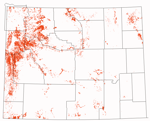
Wyoming landslides shown in red
Wyoming landslides shown in red
These web pages have been generated for two reasons. The first of these is to increase awareness of landslides in Wyoming. The second is to provide citizens with a means to access current landslide data for the state.
The landslides were mapped over a 15-year period by the Geologic Hazards Section of the Wyoming State Geological Survey. Over 850 7.5-minute quadrangles have been mapped for landslides. The Wyoming State Geological Survey (WSGS) and the Water Resources Data System (WRDS) are in the process of generating coverages of them for Wyoming.
For information on or copies of landslide maps not yet represented on this website, contact:
Wyoming State Geological Survey
PO Box 3008
Laramie, WY 82072
(307) 766-2286 x225