| |
 | |
| WRDS/SCO is currently working remotely so there may be a slight delay returning phone calls. Please email wrds@uwyo.edu if you are in need of information and we will respond as soon as possible |
|
| ||||||||||||
Drought Impacts and Outlook Summaries - 12 June 2019View this Summary as a PDF
Highlights for the State
Drought
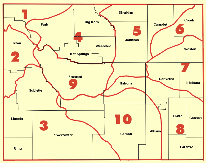
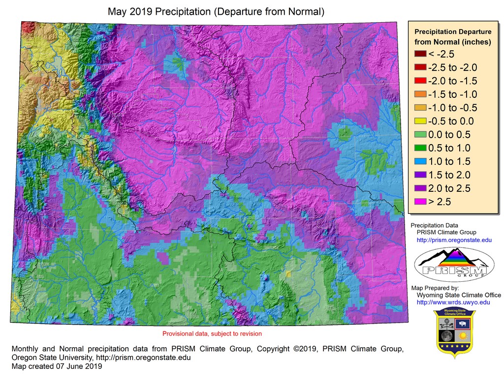
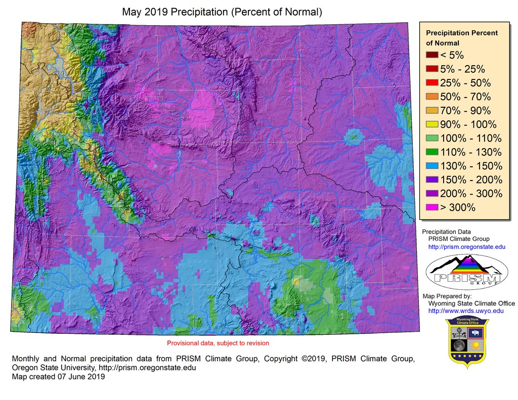
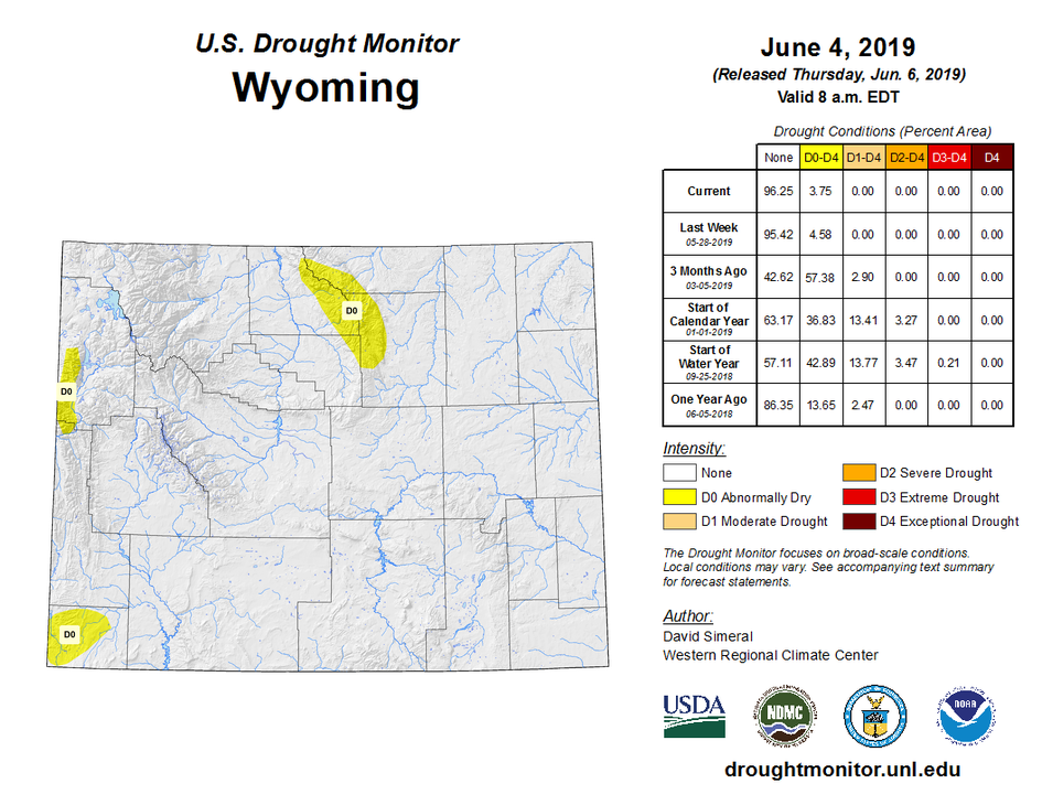
In the Wind River Mountains the D0 area was reduced in size leaving just the higher-elevations of the range impacted. The remaining D0 was removed the first week of June. D0 was also removed from Sweetwater County and part of Uinta County. The only increase of drought at the end of May was in the Tetons where D0 conditions expanded northward to about the northern end of Jackson Lake. The big improvement came in north-central Wyoming. In this region, rain and late-May snows brought some relief to the areas of D0 and D1 such that, by late May, the areas of D0 were drought-free and the D1 in the Bighorns had improved to D0. With good chances for above-average precipitation the next two weeks, these areas of drought could see more improvement.
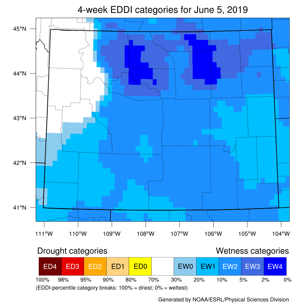
Evaporative Demand
The Evaporative Demand Drought Index (EDDI) is a measure of the "thirst" of the atmosphere and how much moisture it is taking up. This intake of moisture causes a drying of vegetation and soil at the surface. Looking at the situation over the last two weeks, the main area of the state showing normal conditions is the northwest. The rest of the state is in low-demand conditions, meaning the uptake of moisture to the atmosphere is less than normal. The 4-week period ending June 5 shows much the same conditions. Additional products can be found at: http://www.wrds.uwyo.edu/sitemap.html Do you have drought impacts to report? We need your on-the-ground reports and you can input them here: http://droughtreporter.unl.edu/submitreport/
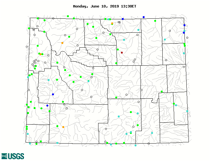
Water Resources Reservoir conditions may be viewed online in larger format at: http://www.wrds.uwyo.edu/surface_water/teacups.html Streamflows in Wyoming are at or above normal. Currently, only five stations (one each in Teton, Park, Sheridan, Johnson, and Sweetwater Counties) have below normal flows. The map below shows streamflow conditions in Wyoming as of June 10.
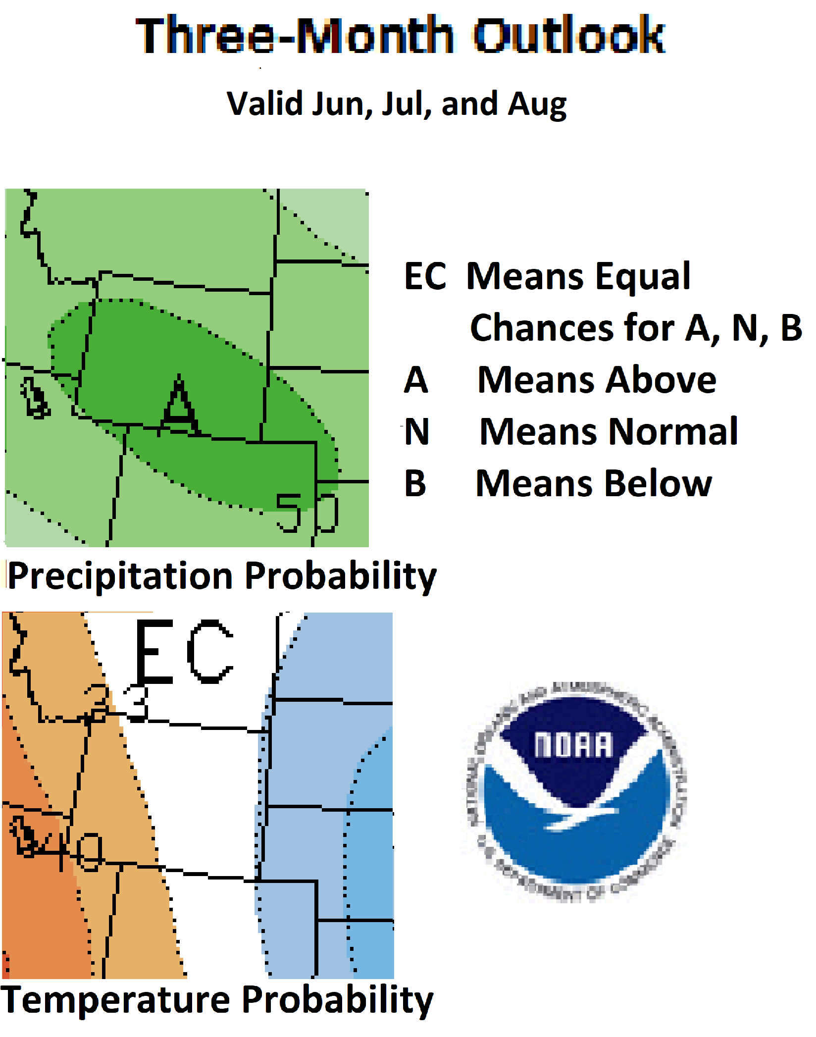
Weather and Climate Outlooks For temperature there is a mix of conditions with the eastern two-thirds of the state having odds that favor below-normal temperatures. While the signal is not very strong, the northwestern parts of Wyoming could see above-normal temperatures for the earlier part of this period. With the expectation of above-normal precipitation and below-normal temperatures over the coming weeks, along with the very low evaporative demand conditions, some areas of drought are expected to improve. A possible exception to this could be the area of D0 (Abnormally Dry) in Teton County where there are chances of above-normal temperature. This region is also showing normal evaporative demand as opposed to the very low demand over much of the rest of Wyoming.
You can help us
Heard around the State Washakie County, May 04: "The 7" of snow and we got this week soaked in fast. The freezing temps overnight took out lots of flowers and our asparagus." Converse County, May 10: "Its great for the ground but hard to plant things in mud." Sheridan County, May 12: "Wet early spring, slowing down my yard activities. Farmers and ranchers happy for the moisture, pastures and hayfields getting a good start." Natrona County, May 26: "I took a core sample in the front pasture. The ground is wet, what would be considered well irrigated, down to 24 inches."
Partners
Stay Tuned and In Touch Live in or around the Wind River Indian Reservation? Check out the Wind River Indian Reservation and Surrounding Area Climate and Drought Summary at: WindRiverRes-Climate-Drought-Summary-Mar2017.html |
||||||||||||