| |
 | |
| WRDS/SCO is currently working remotely so there may be a slight delay returning phone calls. Please email wrds@uwyo.edu if you are in need of information and we will respond as soon as possible |
|
| ||||||||||||
Drought Impacts and Outlook Summaries - 28 May 2019View this Summary as a PDF
Highlights for the State
Drought
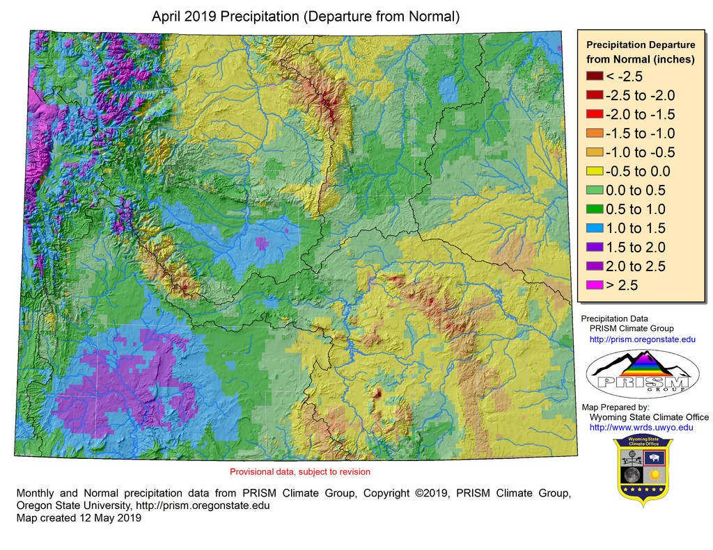
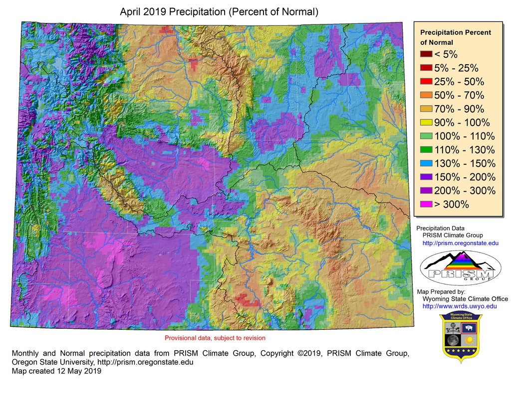
D1 (Moderate Drought) conditions in the southwest were upgraded to D0 (Abnormally Dry) in Uinta County and removed completely from Lincoln County during the last week of April. Large areas of D0 were also removed between Uinta and Hot Springs Counties with only the high elevations of the Wind River Range remaining. D1 conditions emerged the week of the 9th of April in the Bighorn Mountains in north-central Wyoming. During the first week of May, D0 began to form in the Tetons in extreme northern Lincoln County extending to the north end of Jackson Lake. A moist pattern laying over the state in the coming weeks should see many of these areas improving, although drought could linger longer in the higher-elevations of the Bighorn Mountains.
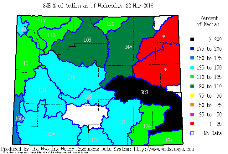
Snowpack
Additional products can be found at: http://www.wrds.uwyo.edu/sitemap.html Do you have drought impacts to report? We need your on-the-ground reports and you can input them here: http://droughtreporter.unl.edu/submitreport/
Water Resources Reservoir conditions may be viewed online in larger format at: http://www.wrds.uwyo.edu/surface_water/teacups.html Downstream, Lake Mead continues to hold at around 40% capacity while Lake Powell has increased to about 41% from a low of around 37% near the end of April. The map below shows reservoir conditions in Wyoming as of 22 May.
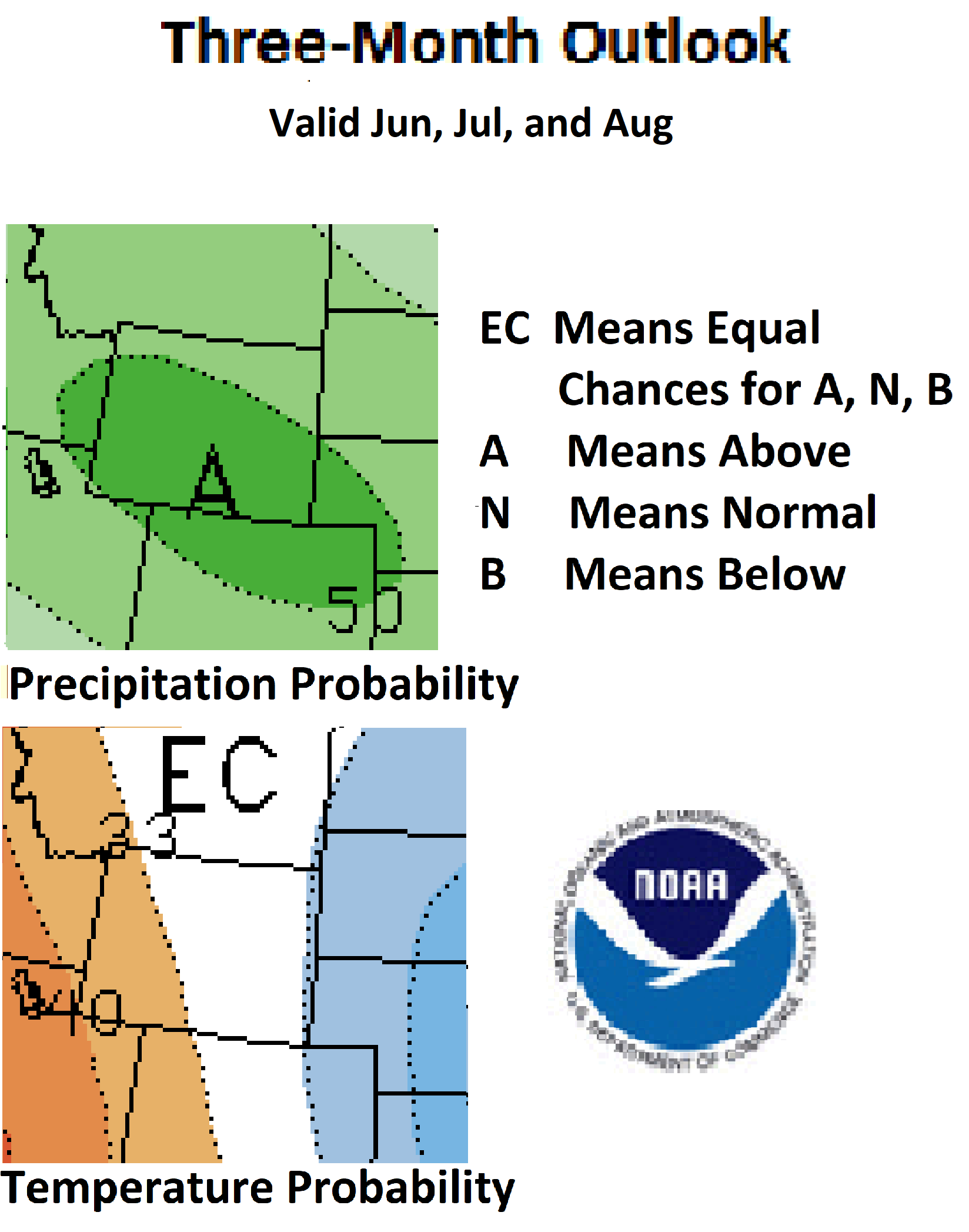
Weather and Climate Outlooks Moving into June the temperature signal fades such with even chances for above, below, or just normal temperatures. For precipitation, though, the signal remains for above-normal amounts across the entire state. As we move into the summer months, the June through August and July through September time frames both show increasing chances of above-normal temperatures in the western parts of the state although there is still no clear indication for the rest of Wyoming. For precipitation, however, the signal is showing above-normal amounts throughout the summer and into fall with the chances being 50% or better during the June to August period. With the expectation of above-normal precipitation over the coming months, drought conditions are likely to improve although the D1 in the Bighorn Mountains may linger beyond the other areas.
You can help us
Heard around the State Johnson Co., Apr 01: "glad to have it dry up these last few days; driveway was getting really difficult to navigate from the mud." Washakie Co., Apr 20: "Rototillars have been busy. Many people have put in their cool weather crops. Farmers are burn clearing fields." Natrona Co., Apr 22: "The country is getting greener and greener. The grass is growing very well. My fields dried out enough that I was finally able to start field work, but after last nights rain I will have to wait a day before doing more." Laramie Co., Apr 30: "Soil moisture conditions are almost ideal here in SE Wyoming, NE of Cheyenne, and they have been good all winter and spring."
Partners
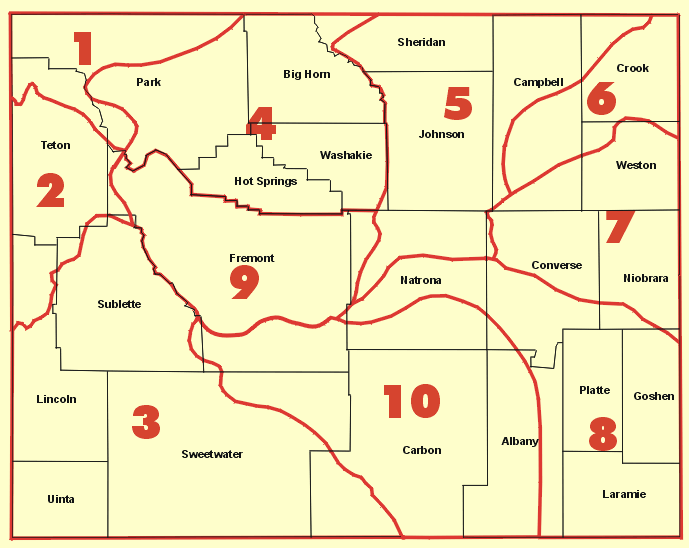
Stay Tuned and In Touch Live in or around the Wind River Indian Reservation? Check out the Wind River Indian Reservation and Surrounding Area Climate and Drought Summary at: WindRiverRes-Climate-Drought-Summary-Mar2017.html |
||||||||||||