| |
 | |
| WRDS/SCO is currently working remotely so there may be a slight delay returning phone calls. Please email wrds@uwyo.edu if you are in need of information and we will respond as soon as possible |
|
| ||||||||||||
Drought Impacts and Outlook Summaries - July 2018View this Summary as a PDF
Highlights for the State
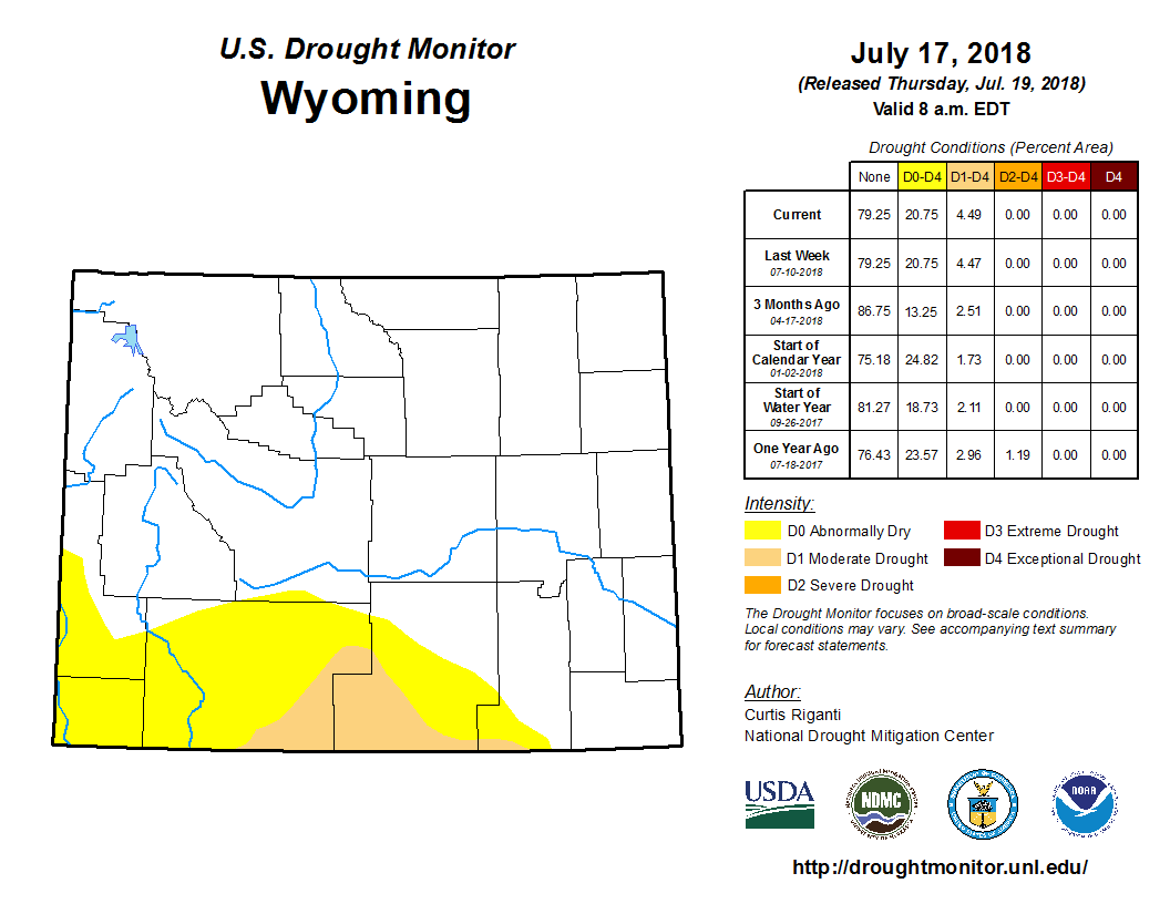
Drought
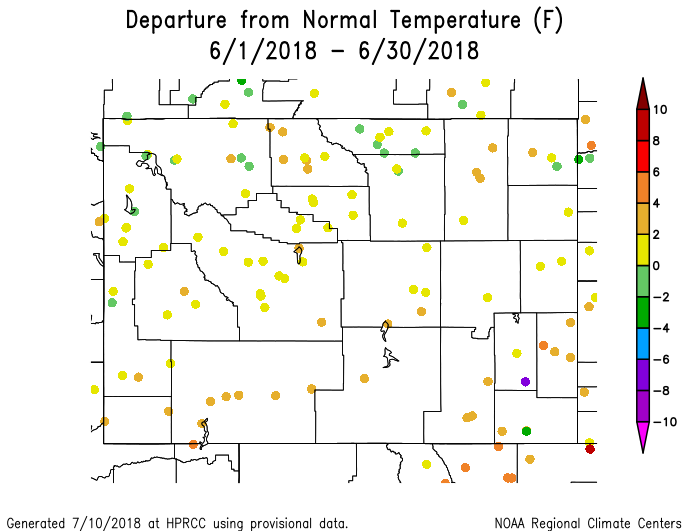
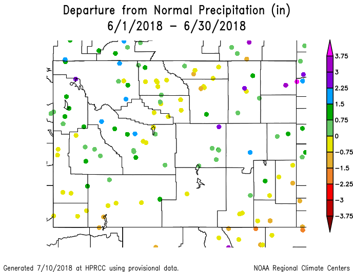
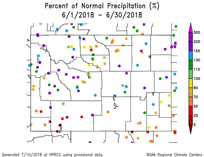
Surrounding the D1, D0 (Abnormally Dry) conditions extend all the way to the Utah border in the west, northward into extreme southern Fremont County, and eastward into the southwestern portions of Albany County. Precipitation in the eastern half of the state has been generally above-normal which should help keep drought conditions from setting in there. The valley areas of the Wind and Bighorn River basins have also received normal to above-normal precipitation. Remaining areas of the state have received below-normal precipitation in the last 30 days and could be susceptible to D0 conditions, especially the northwest where evaporative demand has been high.
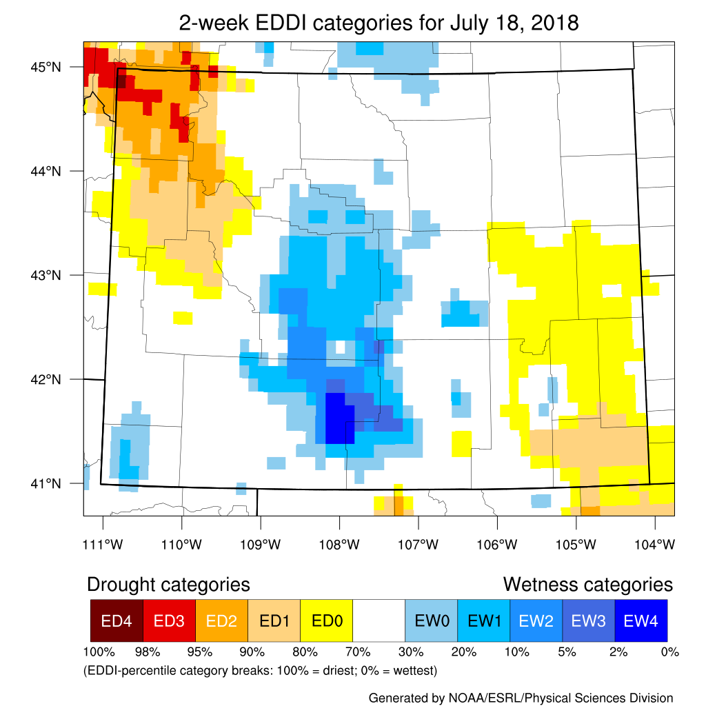
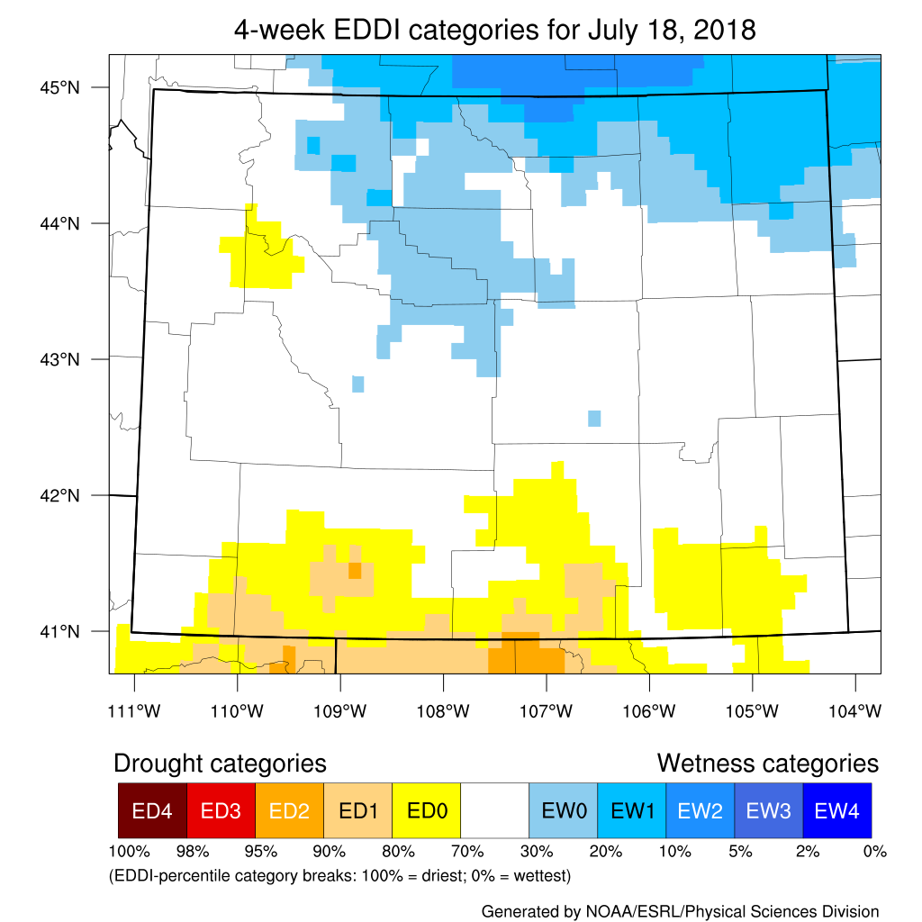
Evaporative Demand Drought Index
Looking at conditions over the last four weeks, the EDDI is showing low-demand conditions for the northcentral and northeastern parts of Wyoming. Some areas of high-demand are emerging in the southern tier of the state. Additional products can be found at: http://www.wrds.uwyo.edu/sitemap.html Do you have drought impacts to report? We need your on-the-ground reports and you can input them here: http://droughtreporter.unl.edu/submitreport/
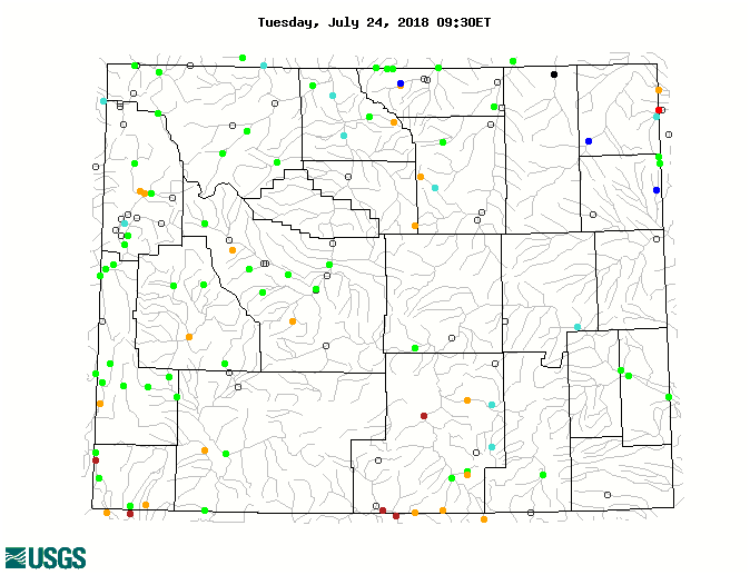
Water Resources Reservoir conditions may be viewed online at: http://www.wrds.uwyo.edu/surface_water/teacups.html Streamflows in Wyoming are running mostly at normal or above normal; however, there are several sites in the southern part of the state that are well-below normal, as are five others in northcentral and northwestern Wyoming. The map below shows stream conditions in Wyoming as of July 24.
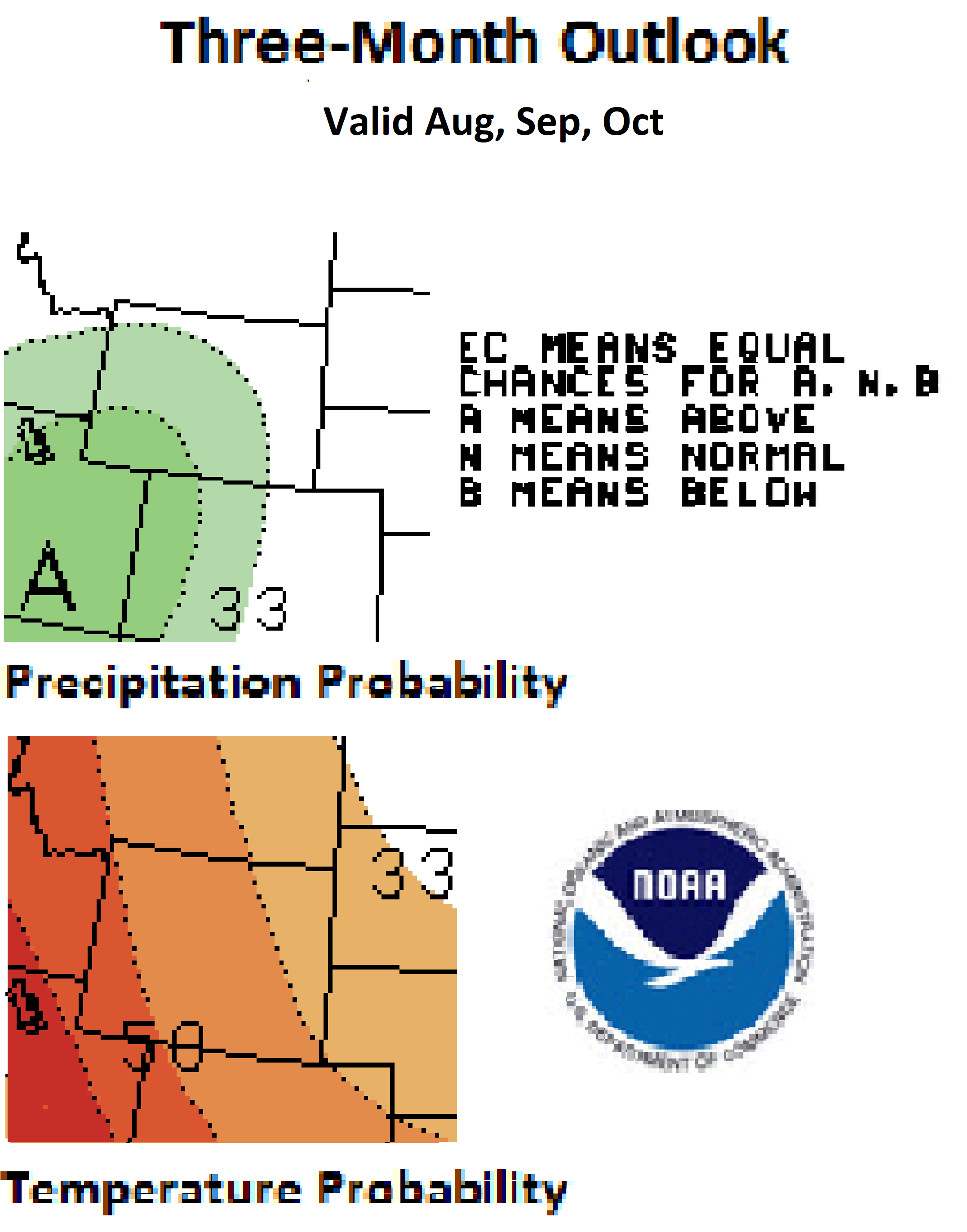
Weather and Climate Outlooks Looking ahead to the three-month period of August through October there are increased chances for above-normal temperature statewide. Those chances are highest in the southwest and decrease to the northeast. Precipitation amounts during this period of time are expected to be above normal for the southwestern three-quarters of the state. Moving forward to September through November, there are, again, good chances for above-normal temperatures statewide with the odds being better than 50% in the southwest half of Wyoming and slightly less in the northeast. Precipitation signals for that period are uncertain. Drought conditions are expected to continue in southcentral Wyoming. With the high evaporative demand being experienced in the northwest and, to a lesser extent, the southeast, Abnormally Dry conditions could expand into those areas in the coming weeks.
Heard around the State Carbon Co., Jun 24: On May 28 I observed a tornado, a rare sight, to the east over the Beaver hills. The hayfields are stressed, even though they are irrigated. Ranchers are worried they will be short of hay to feed their livestock. Weston Co., Jun 16: Our grass is beautiful! Clover blooming. Lots of cactus blooming, lots of mosquitoes. With not too much heat and rather normal T-showers we are set for a great grass year.
Partners
Stay Tuned and In Touch Live in or around the Wind River Indian Reservation? Check out the Wind River Indian Reservation and Surrounding Area Climate and Drought Summary at: WindRiverRes-Climate-Drought-Summary-Mar2017.html |
||||||||||||