| |
 |
|
| ||||||||||||
Drought Impacts and Outlook Summaries - April/May 2017View this Summary as a PDF
Highlights for the State
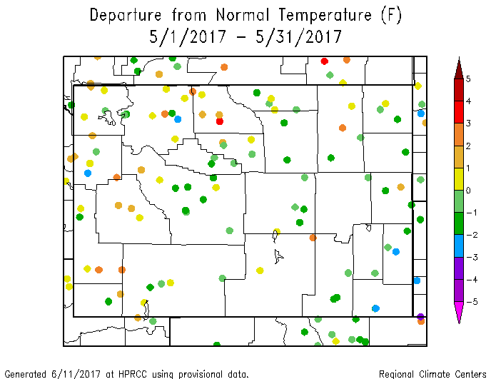
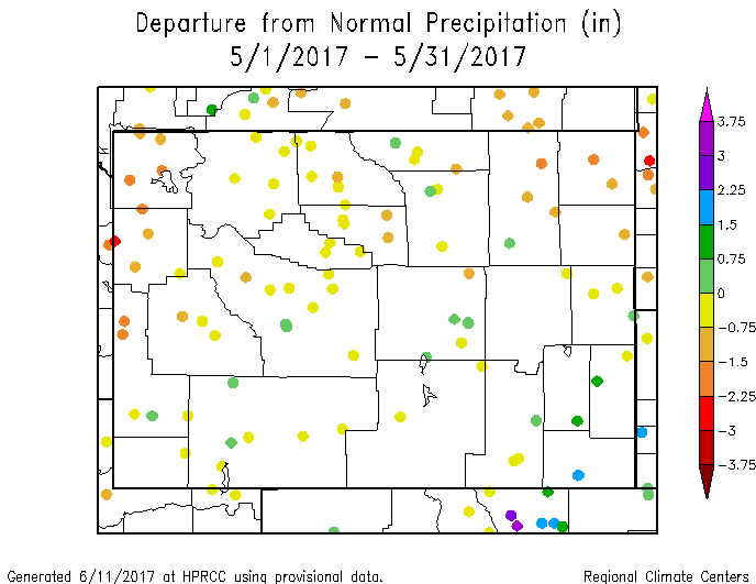
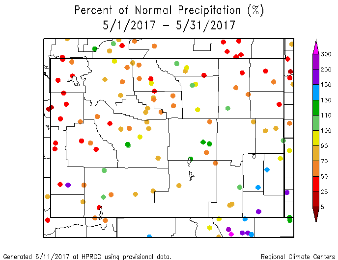
May temperatures were somewhat below normal for much of Wyoming. Only the western counties of Lincoln, Sublette, Teton, Park, Big Horn, and western Fremont counties were above normal. Statewide May was the 53rd warmest of the last 123 years. For statewide precipitation, April was the 10th wettest of the last 123 years. Climate Division (CD) 5 was the wettest in the state and it ranked as having the 3rd wettest April since 1894. May was a dry month for much of the state. The southeast part of the state was a little above normal and a few stations in the west were up to 200% of normal but far more were as little as 25-50% of normal. This includes stations in the only remaining drought area of the state; Crook and Weston counties. CDs 1 and 2 were the driest, both ranking as the 9th driest since 1894. The state, as a whole, ranked as the 46th driest of the last 123 years.
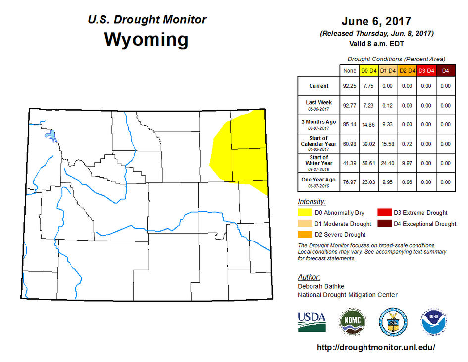
Drought
In the northeast D1 conditions were recently removed from Crook and Weston counties. D0 still remains in most of Crook and Weston counties as well as much of eastern Campbell County. Abnormally Dry conditions expanded into northern Niobrara County in the last week. Despite this expansion, conditions are an improvement over what they were at the time of the last Outlook. Drought conditions are expected to continue in northeastern Wyoming where precipitation has been below normal.
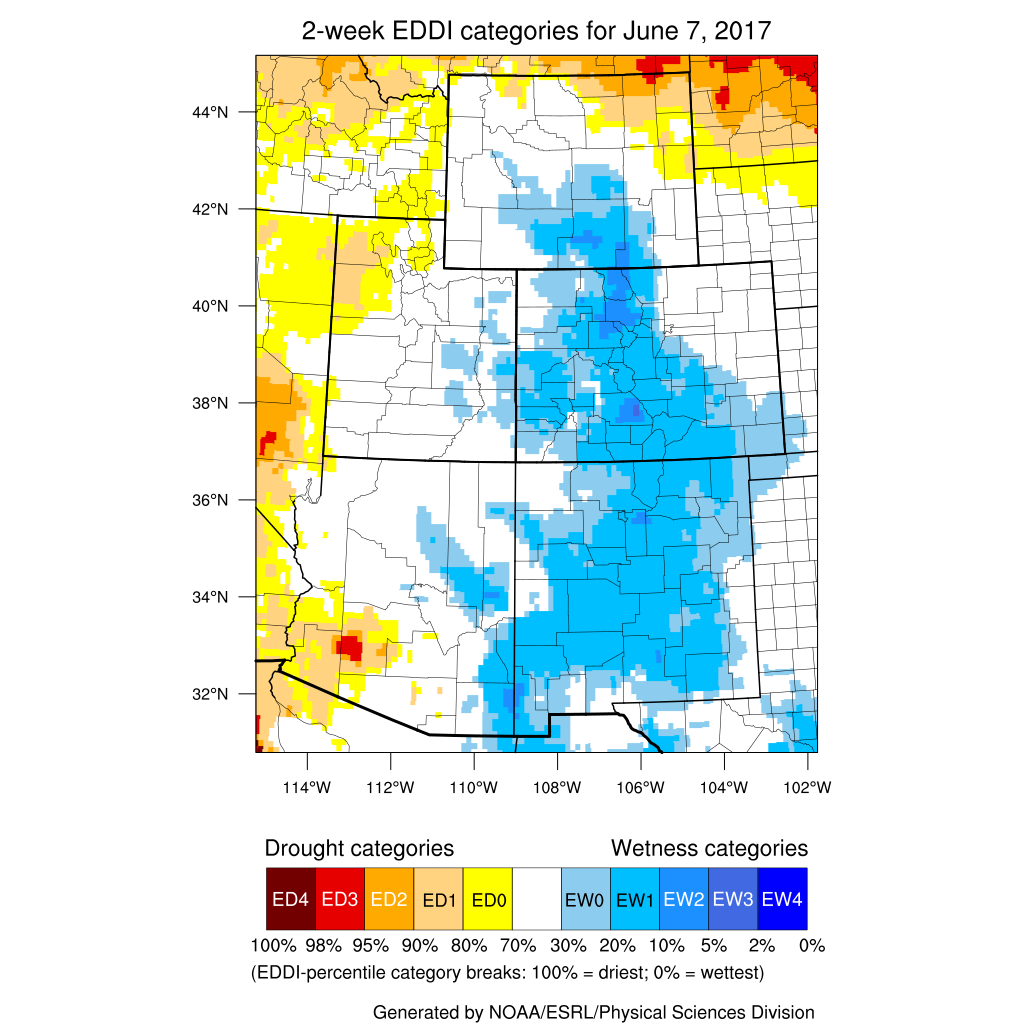
Snowpack/Evaporative Demand Drought Index
The Evaporative Demand Drought Index is showing good conditions across most of the state at the 4-week window but the 2-week view shows some developing concerns in the northeastern part of the state again. Eastern Sheridan and northern Campbell and Crook counties are the areas of greatest concern at present. Snow pack products can be found at: http://www.wrds.uwyo.edu/sitemap.html Do you have drought impacts to report? We still need your on-the-ground reports and you can input them here: http://droughtreporter.unl.edu/submitreport/
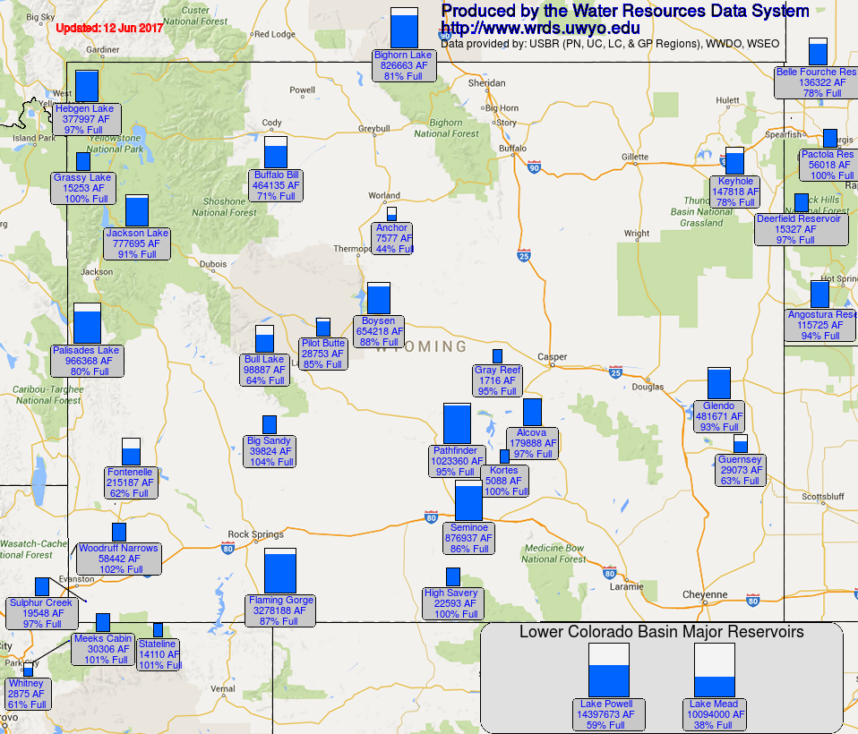
Water Resources The map below shows reservoir conditions in Wyoming as of 12 June. This map may be accessed online at: http://www.wrds.uwyo.edu/surface_water/teacups.html
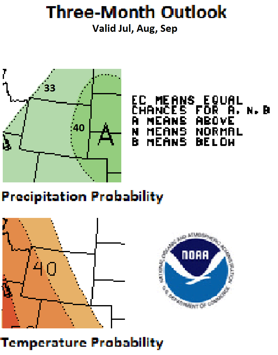
Weather and Climate Outlooks For the next two weeks, Wyoming looks to have better chances for above-normal temperatures whereas precipitation during the first ten days is more likely to be below-normal for all of Wyoming except the south central and southeast parts. For the latter part of the period, there are even chances of above, below, or normal precipitation. Looking at the period of July through September, there are better chances for above-normal temperature except for the area east of a line from the southeast corner running northwest to the Sheridan area. Precipitation during this period of time is favored to be above normal with chances better in the eastern quarter of Wyoming. Moving forward to August through October, there are good chances for above-normal temperature statewide. Precipitation is expected to be above normal for all but the northwest corner of the state. Drought conditions are expected to persist in the northeast part of the state. This area is starting to see soil moisture conditions a bit below normal and, while temperatures in May were below normal, so was precipitation. The late May snow storm brought relief to the southern part of the state however soil moisture levels in the Sweetwater and Carbon counties area are below normal.
Heard around the State Sheridan Co., May 14: It is a lush spring. The tulips are gorgeous. The dry hills are very green from the past moisture in April and May, Clear Creek started flooding its low banks. Laramie Co., May 18: Heavy wet snow after rain are preventing us from very good oversight of our ranch and cattle. But the moisture is fabulous and precious. We'll wait it out. Weston Co., Jun 01: Cool season grasses are good to date.no frost for 2 months and 3/10 of moisture each week has helped. Now with 85. and wind, the wheatgrass has the silvery sheen and there is no soil moisture.
Partners
Stay Tuned and In Touch Live in or around the Wind River Indian Reservation? Check out the Wind River Indian Reservation and Surrounding Area Climate and Drought Summary at: WindRiverRes-Climate-Drought-Summary-Mar2017.html |
||||||||||||