| |
 | |
| WRDS/SCO is currently working remotely so there may be a slight delay returning phone calls. Please email wrds@uwyo.edu if you are in need of information and we will respond as soon as possible |
|
| ||||||||||||
Drought Impacts and Outlook Summaries - September 2016View this Summary as a PDF
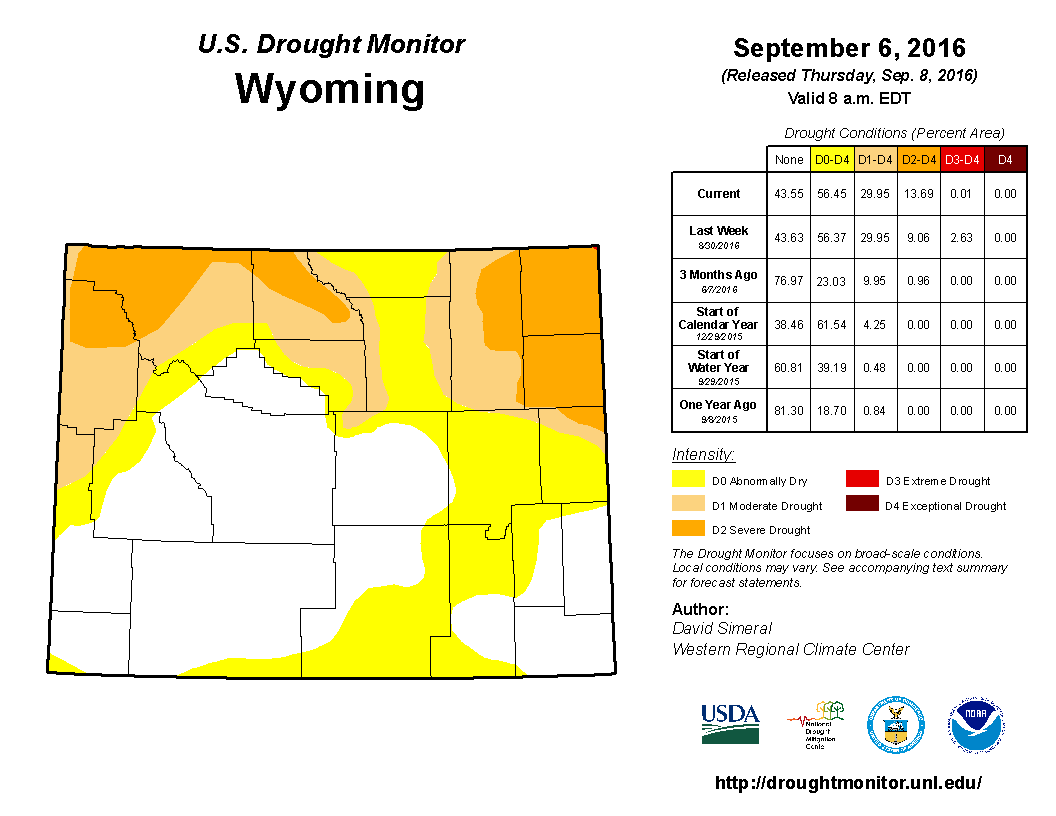
Since mid-August, drought in the northeast has lessened some and extreme drought (D3) was removed from Crook and Weston counties. In the southeast, D0 conditions were reduced in eastern Laramie and Goshen counties. Conditions worsened in the western half of the state with D0 being expanded to cover southwestern Carbon and southeastern Sweetwater counties as well as the southwest corner of Uinta County. A major expansion of D1 occurred in the northwest to cover most of Park, almost all of Teton, northwestern Sublette, and northern Lincoln counties. Following the D1 expansion, severe drought (D2) began to cover northern Teton and northwestern Park counties.
Although recent rains have been beneficial for eastern and north-central Wyoming, much of the state still needs moisture and fire potential remains above normal, especially in the northwest. Currently 17 fires are considered active in Wyoming with most of those being in the northwest (Yellowstone and Teton National Parks or Shoshone National Forest).
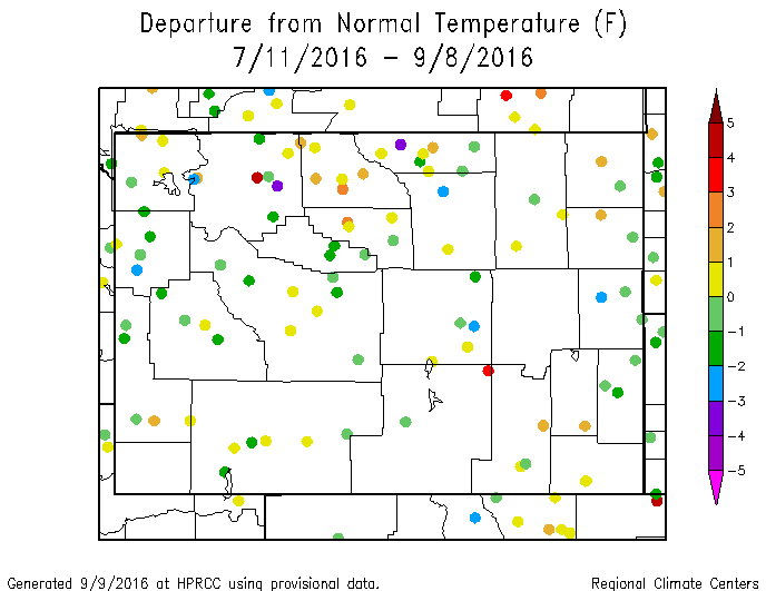
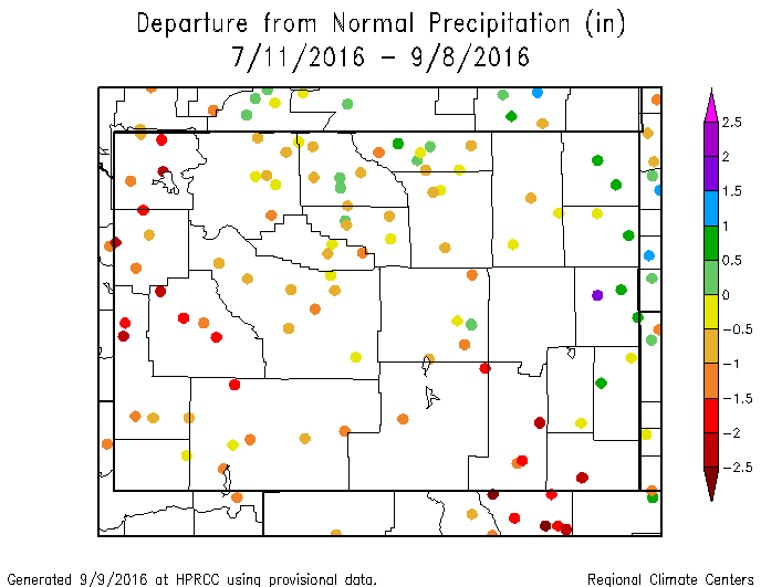
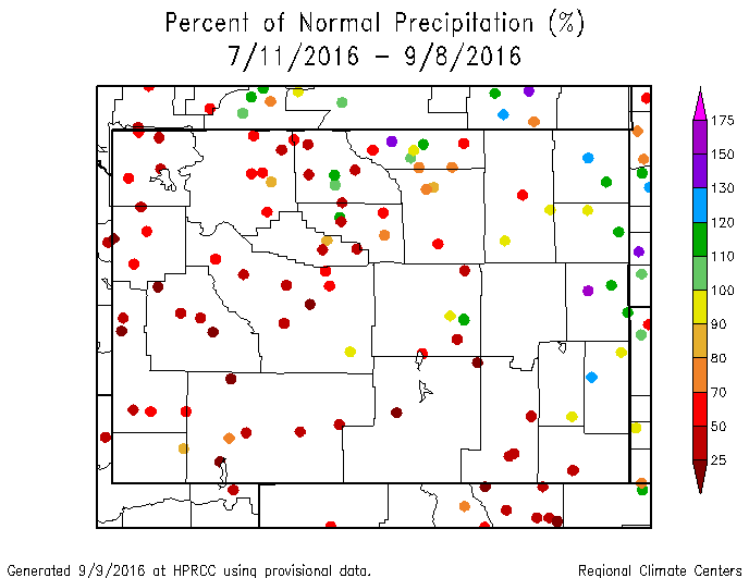
Temperature and Precipitation Anomalies Extreme eastern counties (Crook, Weston, Niobrara, Goshen) as well as parts of north-central Wyoming (Big Horn and Sheridan counties) had normal to above-normal precipitation while most of the rest of the state was 70% or less of the normal.
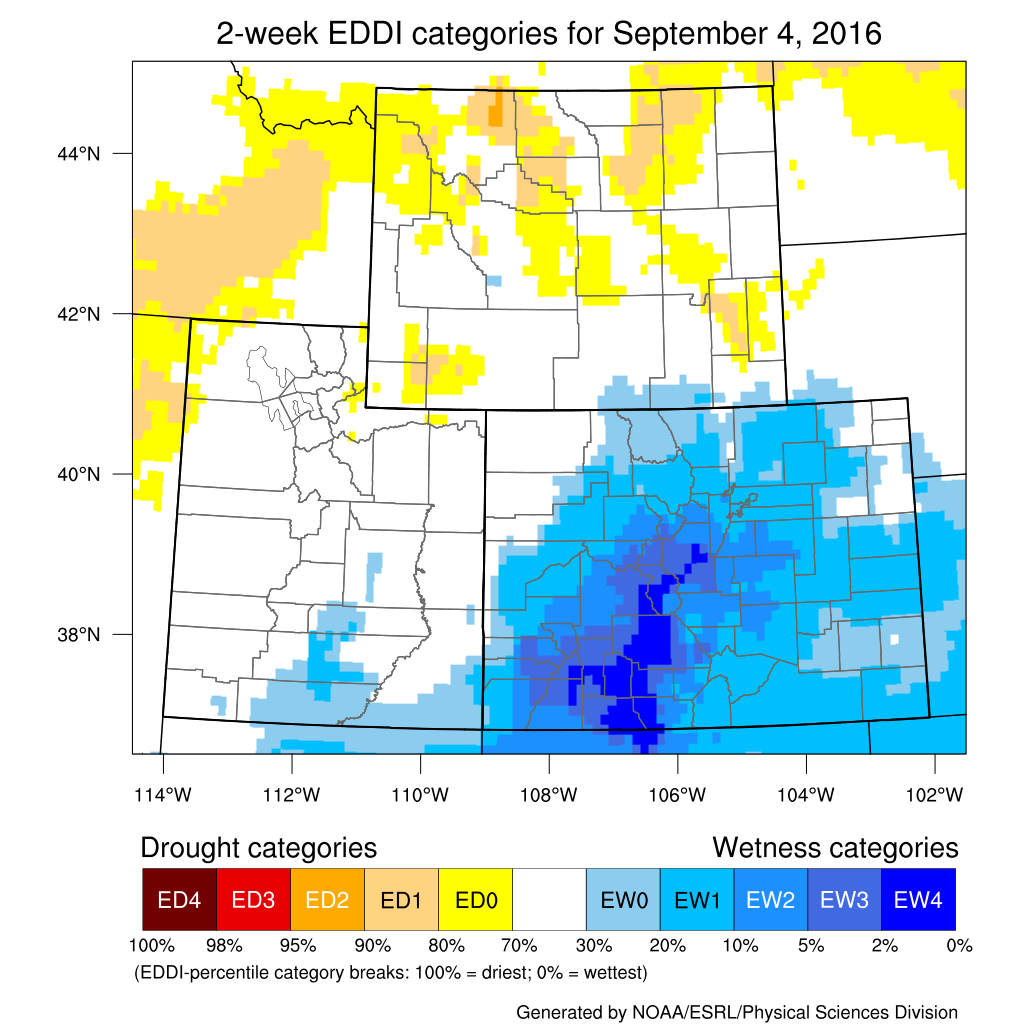
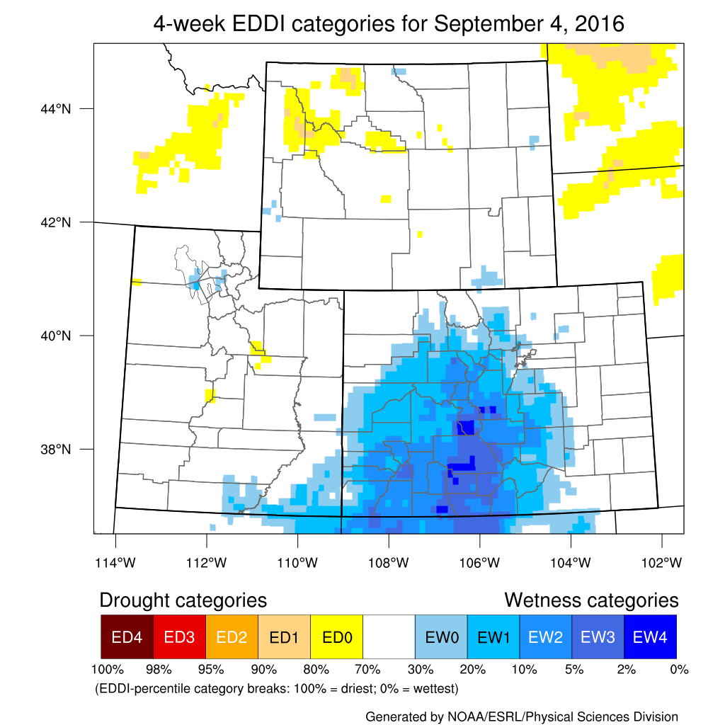
Evaporative Demand EDDI maps are updated on a daily basis for several timeframes. Current maps may be downloaded here: http://wwa.colorado.edu/climate/dashboard.html
Water Resources The map below shows streamflow for September 8th compared to the historical average for this date.
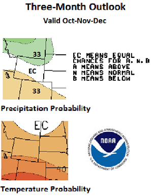
Weather and Climate Outlooks Looking farther out, the signals are less certain for precipitation. The Oct-Dec period has good chances for above-normal temperature, while precipitation is more uncertain with greater chances for above-normal precipitation in the north and below-normal precipitation in the southwest. Moving to the Nov-Jan timeframe, above-normal temperatures are still favored for the southwestern two-thirds of Wyoming. It is more likely that the northern half of the state will see above-normal precipitation with the lower half being uncertain. Into the winter months of Dec-Feb, above-normal temperatures are still favored for southwestern Wyoming while the northern two-thirds of the state has better chances for above-normal precipitation. Drought conditions likely will persist in the north through September with continued development likely in the northwest. Improvements should be seen in the northeast over the next two to three months.
Summary of Conditions Precipitation for the same period has been below normal for the south and west and above normal for the northeast. Drought has intensified in the northwest and southwest parts of the state but has improved somewhat in the east.
Partners
Stay Tuned and In Touch Live in or around the Wind River Indian Reservation? Check out the Wind River Indian Reservation and Surrounding Area Climate and Drought Summary at: http://www.hprcc.unl.edu/pdf/Wind-River-Climate-Drought-Summary_Sep16.pdf |
||||||||||||