| |
 | |
| WRDS/SCO is currently working remotely so there may be a slight delay returning phone calls. Please email wrds@uwyo.edu if you are in need of information and we will respond as soon as possible |
|
| ||||||||||||
Drought Impacts and Outlook Summaries - August 2016View this Summary as a PDF
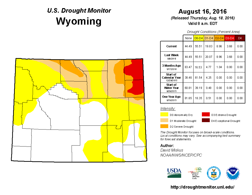
Since mid-July, drought in the northeast has lessened some and extreme drought (D3) was reduced in Crook and Weston counties while severe drought (D2) was reduced in southern Campbell County. Moderate drought (D1) increased in northcentral WY to cover most of Big Horn County, northeast Park County, and western parts of Johnson County. Abnormally dry conditions (D0) expanded to cover all of Park County, the northern half of Lincoln County, and more of the western parts of Fremont and Sublette counties. D3 was introduced along the western flank of the Bighorn mountains northward to the MT border and westward into Park County. In the south, D1 emerged briefly in eastern Goshen County. The D0 in the southeast portion of WY expanded to cover almost all of Converse, Goshen, and Platte counties as well as the northern and northeastern parts of Albany and Carbon counties respectively. Recently, the D0 improved in the border area between Platte and Goshen counties as well as in eastern Laramie County. Although August rains have been beneficial for the Bighorn Basin and eastern quarter of the state, much of WY still needs moisture and fire potential remains above normal. Currently 17 fires are active in WY including five in Yellowstone NP and two in Grand Teton NP. Outside the National Parks, active fires exist in Park, Sublette, Fremont, Washakie, and Carbon counties.
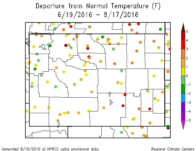
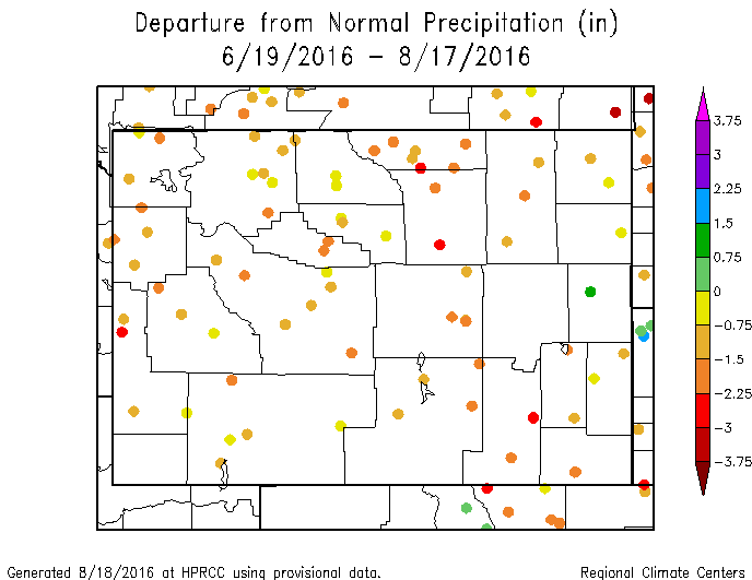
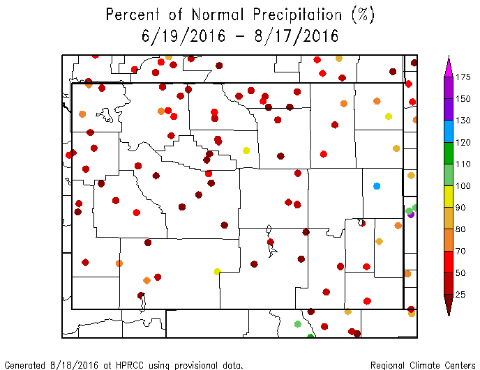
Temperature and Precipitation Anomalies Most of Wyoming experienced well-below-normal precipitation between mid-June and mid-August. Almost without exception, departures from normal were negative with many stations being between 0.75" and 3" below normal. When looked at as a percentage of normal, most of the state was less than 70% of normal with much of that being less than 50% of normal. Northeast Wyoming (Crook, Weston, Converse, and Niobrara counties) was closer to normal with one station in Niobrara County being above normal.
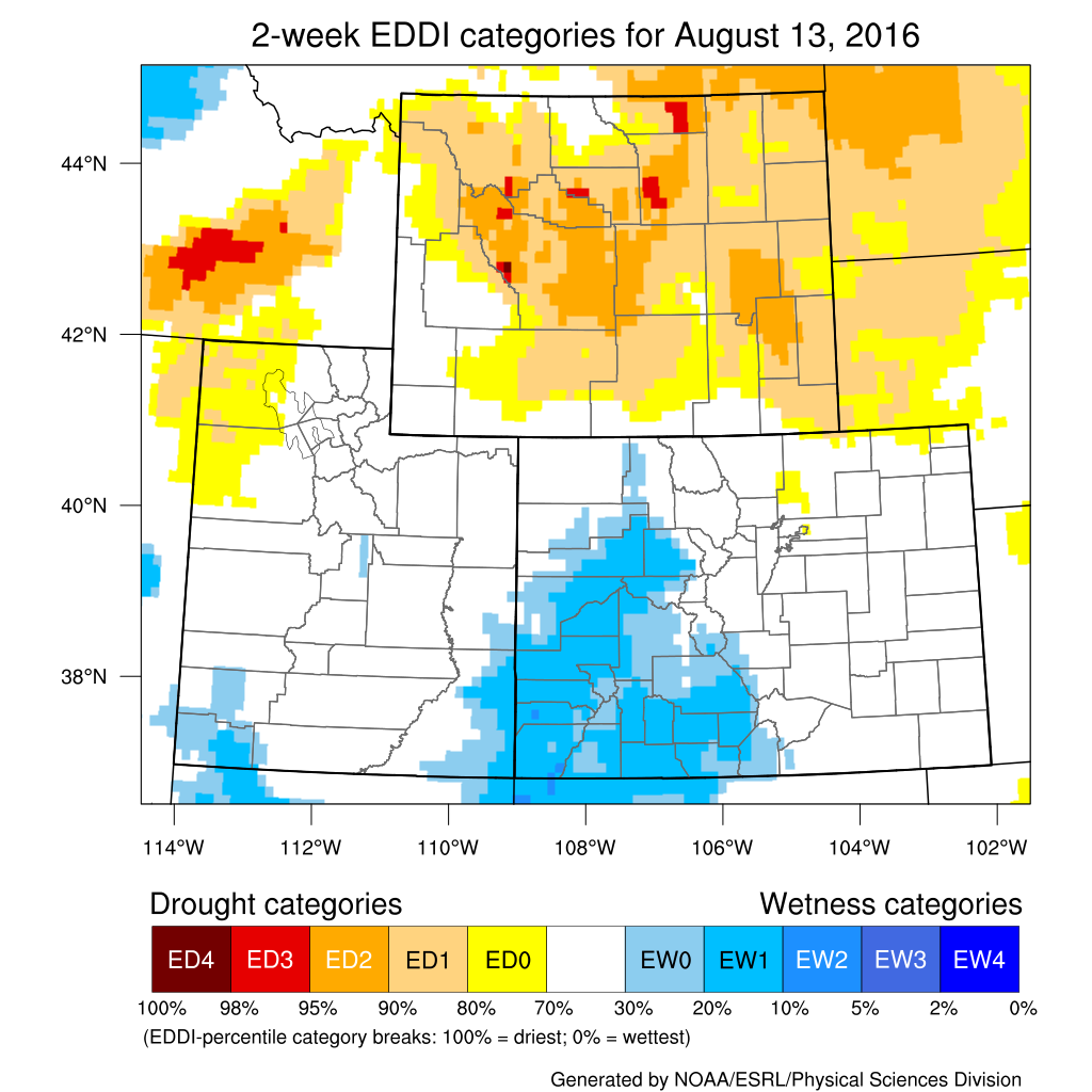
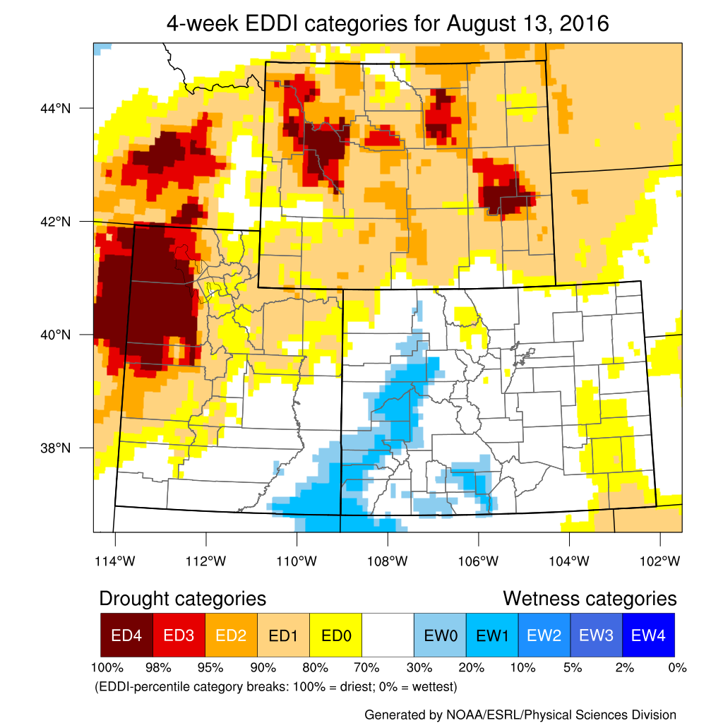
Evaporative Demand EDDI maps are updated on a daily basis for several timeframes. Current maps may be downloaded here: http://wwa.colorado.edu/climate/dashboard.html
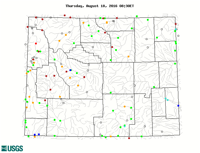
Water Resources The map below shows streamflow for August 18th compared to the historical average for this date.
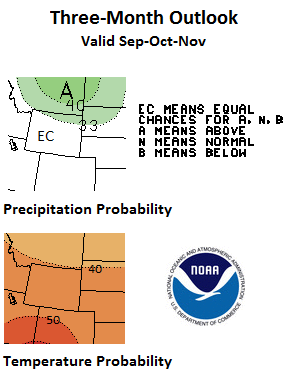
Weather and Climate Outlooks Looking farther out, the signals are less certain for precipitation. The Sep-Nov period has increased chances for above-normal temperatures statewide, but, for precipitation, most of the state has equal chances for above- or below-normal amounts with far-north Wyoming being more likely to see above-normal precipitation. This pattern continues into the Oct-Dec period for temperature, while precipitation is more uncertain though chances are for above-normal precipitation in the north and below-normal precipitation in the south. Moving to the Nov-Jan timeframe, above-normal temperatures are still favored for the southwestern two-thirds of Wyoming. It is more likely that the northern half of the state will see above-normal precipitation with the lower half being uncertain. Drought conditions likely will persist in the north through August with some improvement being seen there over the next two to three months.
Summary of Conditions
Partners
Stay Tuned and In Touch Live in or around the Wind River Indian Reservation? Check out the Wind River Indian Reservation and Surrounding Area Climate and Drought Summary at: http://www.hprcc.unl.edu/pdf/WindRiver-Climate-Drought-Summary-Jun-16.pdf |
||||||||||||