Wyoming Agricultural Climate Network (WACNet)
Wyoming State Engineer's Office
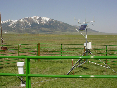
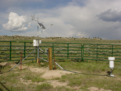
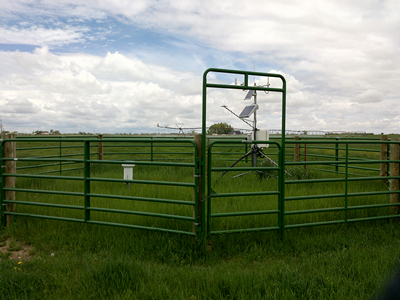
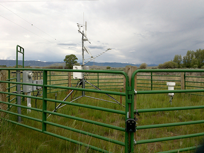
To better understand climate variation and the consumptive use of water, the Wyoming State Engineer's Office
maintains a network of twenty climate stations, known as the Wyoming Agricultural Climate Network (WACNet).
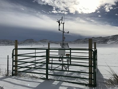
Placed in critical areas to assist in estimating consumptive use of water from irrigated lands, these climate
stations collect a suite of variables which enable the application of the ASCE Standardized Reference
Evapotranspiration Equation. Data collected includes air temperature, humidity, wind speed, wind direction,
solar radiation and precipitation. Some stations have heated precipitations gages to enable year-round
measurement of precipitation and some stations also measure soil temperature. All stations are located in
or adjacent to irrigated fields.
The consumptive use of water from irrigated fields (evapotranspiration; ET) is ultimately driven by atmospheric
conditions. Sound climate instrumentation is of paramount importance in the development of high quality ET
estimates for irrigated lands. Even in cases where actual ET measurements can be made, climate data provides
estimates of potential ET, and then allows for an assessment of shortage. While complex precipitation patterns,
particularly in regards to summer thunderstorms, as well as variation in soil type and moisture, will always
be problematic to ET estimation, good local measurements in agriculturally significant areas will increase the
accuracy of basin-wide seasonal estimates. Full-fledged agricultural weather stations are needed at
representative locations in all basins to support consumptive use analysis.
Data from WACNet are downloaded, QA/QC'd and maintained by the Water Resources Data System at the University of Wyoming.
In addition to the normal climate-based sensors, time-lapse cameras have been installed at two locations in the
Green River Basin. The purpose of these cameras is to collect additional data about field management because
agriculture consumptive use is dependent on irrigation on/off dates, cut dates and other related activities.
The cameras are aimed down at the grass and take pictures at the same time every day. From the pictures we can
see the grass going through its life cycle, irrigation water being applied, when producers cut, if cows were put
on the field after the first cutting and when fall temperatures halt grass growth. These cameras have proven
to be an inexpensive way of collecting additional important information.
For additional information about WACNet, please feel free to contact:
| Jeff Cowley
River Basin Coordinator
Interstate Streams Division
Wyoming State Engineer's Office
(307) 777-7641
jeff.cowley@wyo.gov |
Tony Bergantino
Director
Water Resources Data System
University of Wyoming
(307) 766-6651
antonius@uwyo.edu | | |
|